 Gilbert, Chandler and Mesa boast Waterfront Trail Systems
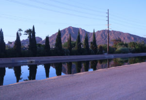
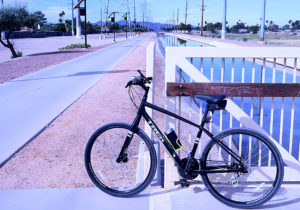
An almost hidden feature of Gilbert, Chandler and Mesa is the recreational trail system that has been developed along the canals that have been in the east valley longer than 99% of the homes. The Consolidated Canal, 18 miles long runs thr0ugh Mesa, Gilbert and Chandler and dates back to 1891. The development of recreational paths along SRP canals has become an attractive amenity in many cities. Bikers and joggers will be most familiar with the paths since they offer a welcome alternative to narrow sidewalks, inattentive passing cars and frequent crossings at stop lights.
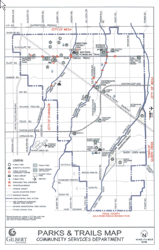
Gilbert Trails and Canal System
Much of Arizona’s history is tied to water and the distribution of this valuable resource. Canals were an integral part of the early infrastructure. The canals in Gilbert serve as boundaries for those areas that have SRP water rights in the town. It is natural that the bike, walking and equestrian pathways would follow these natural landmarks.
In Gilbert, the Western Canal Powerline /Sun Circle Trail runs east and west, connecting Big League Dreams, the Riparian Preserve, Freestone Park and the McQueen District Park in a 8.5 mile stretch. It continues west into Chandler and also Tempe. Anyone looking for a peaceful bike ride or jog will find this trail enjoyable and with much less congestion than a street sidewalk with cars racing past at 40 miles/hour.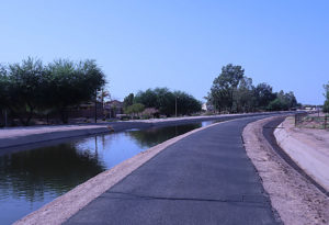
Enlarged map of Gilbert Trail System
The Consolidated Canal was initially conceived by Dr. A. J. Chandler and started in 1891. The Consolidated Canal Trail currently run 18 miles in a north and south
 orientation through Mesa, Gilbert and Chandler. In the 1980’s the trail became popular with walkers, joggers, and bicyclists. Federal grants and city funds have transformed this dirt path into a lighted multi-use trail.
In Chandler It’s the Paseo Trail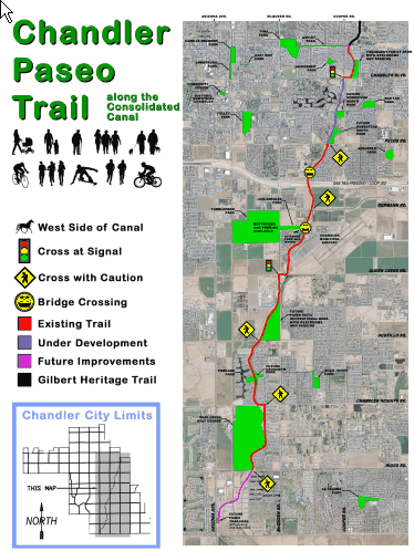
In Gilbert it’s called the Heritage Trail, but cross over into Chandler and now the multi-use trail alongside the Consolidated Canal is the Chandler Paseo Trial. This 6.5 mile trail is a 10 foot wide pathway on the eastern side of the canal. The western side is unimproved that can be used for horseback riding or bicycling. Currently the trail starts at the Tibshraeny Family Park in north Chandler which provides parking and restrooms. The trail heads south past The Springs and crosses the 202 freeway.
Map of Paseo Trail in Chandler
More parking and access to the Paseo Trail is found at Tumbleweed Park and Recreation Center. It’s course continues south passing by Pinelake Estates, a popular waterfront community. The trail currently ends at Riggs Rd although future plans include a southern trailhead near Arizona Ave. and Hunt Highway.
Chandler Lifestyle and Leisure Link
For additional information regarding homes near Gilbert and Chandler recreational trails, call Gordon Baker at 480-326-8571.
Related Link: