 Summer Haboob strikes on July 5th

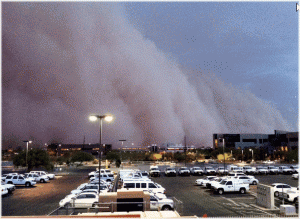
It had its origin in Tucson then progressed northward to Phoenix. The “haboob” arrived in Phoenix late afternoon with winds in excess of 50 mph and a vertical height of 5,000 to 6,000 ft. The picture to the left was taken at the National Weather Service Phoenix office. The storm even shut down Phoenix SkyHarbor Airport for 45 minutes with visibility near zero. While this haboob was one of the largest in history, Phoenix averages about 3 per year during June through September.
The Monsoon brings extreme weather to Phoenix
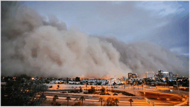 The monsoon brings a drastic change of weather to the valley. The start of the monsoon is technically defined as the third consecutive day when the dew point is over 55 degrees which historically occurs July 7th. However, in 2008, the National Weather Service decided to make it simplier and set the start of the monsoon as June 15 and the official end is September 30th. The monsoon is actually defined as a season, humidity levels increase, and is characterized by wind storms, heavy localized desert rains, microbursts, and dust storms or haboobs. The above picture is courtesy of Mike Olbinski.
The typical Phoenix forecast is clear and sunny. The monsoon provides some real change with a wide variation of weather patterns including the haboob we saw on July 5th.
Related Posts:
Phoenix Arizona Monsoon Thunderstorms